|
.jpg)
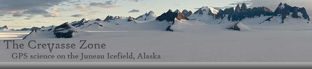
The Juneau Icefield is located in the southeast
panhandle of the state and occupies the eastern
third of the black box.
.jpg)
The Juneau Icefield is located along the crest of the
Coast Mountain Range and extends from Taku Inlet
in the south to Skagway in the north. Every summer,
JIRP members make a south to north traverse of the
Icefield over the course of two months. Lynn Canal
fills a fjord along the southwestern margin of the
Icefield. Juneau, Alaska is located at the bottom
center of the map. Atlin Lake, and the town of Atlin,
British Columbia, are located in the upper right corner.
.jpg)
The traverse of the Icefield begins in Juneau, however
students spend the first few days engaged in orientation
activities such as this field trip to the Mendenhall Glacier.
Here, Dr. Maynard Miller conducts a glacial geology
lecture at the terminus of the glacier.
.jpg)
The first few miles of our journey takes us through
the lush coastal rain forest. With long summertime
days and all the rain that falls, it's no wonder that
the local vegetation grows to such sizes. These
skunk cabbage leaves are large enough that you
could easily build a shelter with them to escape
the rain!
.jpg)
As we climb higher through the forest, occasional
small clearings allow a view toward the Icefield.
Here, the Thomas Glacier is visible in the distance.
.jpg)
The trail from Juneau to the first camp on the
Icefield rises 4,200 feet. Here, we have just
emerged from the forest into the alpine tundra.
We often take a break here to enjoy the scenery
and all the green before we head higher up into
the ice and snow.
.jpg)
Farther up the trail, we cross over a peak and drop
down into the Ptarmigan Glacier valley. Snow
conditions on the Icefield can be determined by
how much snow is remaining in this valley at the
beginning of July. In July 1988, the valley floor
was still covered with 8 feet of snow! Notice
the people crossing the patch of snow.
.jpg)
This is the near the terminus of the Lemon Glacier as it
plunges over a cliff into the valley bottom below. The
small building is one of the research camps utilized by
the Juneau Icefield Research Program.
.jpg)
After a long day's hike, the reward comes when
we arrive at Camp 17 and are presented with this
view. At 4,200 feet above Lynn Canal, the view
is spectacular. The Juneau airport is visible in the
lower left corner of the photo.
.jpg)
This is Camp 17. It sits on a ridge between the
Lemon Glacier on the left and the Ptarmigan
Glacier on the right. The blue tarps on the snow
serve as our water system for melting snow.
.jpg)
After leaving Camp 17, the route takes us up even
higher; over Nugget Peak and down to a tent site on
a small nunatak. It's a rare day indeed when the
weather is this nice at this location. While we're
in bright sunshine, Juneau endures yet another rainy
day below the clouds.
.jpg)
The trail from Camp 17 to Camp 10 requires a
2-day ski. This is an intermediate tent camp
that provides a nice place to rest and relax.
The scenery's not bad either.
.jpg)
Here's a nice sunset taken from the tent camp
that is shown in the previous photo.
.jpg)
This is the northwest branch of the Taku Glacier.
The source area of the Mendenhall Glacier is just
out of the photo to the right. If you click the photo
you'll see in the larger version a small dot on the glacier
in the lower left corner. This is one of our over snow
vehicles headed toward the big snow-covered
peak to do some mass balance work.
.jpg)
After leaving Camp 10, the route takes us around
the base of a peak called Taku C. Usually, we stay
in the middle of the glaciers, as the crevasse danger
in those areas in negligible. Sometimes however,
we'll take advantage of clear weather to find a shortcut
around the base of a peak, as shown here. These areas
also present minimal crevasse danger. This is because
ice flowing down the steeper slopes of the mountain
gets compressed at the base where the slope lessens.
The result: no crevasses!
.jpg)
This is a view looking west to the northwest branch
of the Taku Glacier. Recent seismic reflection
studies reveal the ice to be approximately 1,645
meters (5,400 feet) thick in the center distance.
This puts the bed of the glacier at 175 meters
(575 feet) below sea level. If the Taku Glacier
were to completely melt, this area would be either
a fiord or a huge lake.
.jpg)
This is a view north to the Gilkey and Bucher Glaciers
from a vantage point on the northwest branch of the
Taku Glacier. Referring to the previous photo, this
picture was taken from a ridge shown along the right-hand
side of the photo. The glacier in the valley 900 meters below
is rapidly downwasting and is heavily covered with debris.
Looking south from this vantage point is the Taku Glacier
as seen in the previous photo.
.jpg)
Here's a small camp located midway between two
of the main camps. This one is located about 8 miles
from the Alaska/Canada border on the Alaska side.
While these small camps are far from luxurious, they
are much more comfortable than a flapping tent! |
|
.jpg)
Continuing across the Icefield, we come to Camp 18,
pictured here. This camp is situated on a nunatak high
above the Gilkey Glacier.
.jpg)
Here's another view of the Gilkey Glacier from
Camp 18. This was taken just as a storm was
breaking. The portion of the glacier to the left
of the medial moraine has an excellent series of
band ogives. These are formed by the Vaughan
Lewis Icefall near Camp 18.
.jpg)
The majority of our time on the Icefield is spent in the
accumulation area. This is the area in which the snow on
the glacier never completely melts. The Gilkey Glacier,
shown here, provides an opportunity to carry out research
in the ablation zone. Being 2,000 feet lower in elevation
than the surrounding Icefield, the ice is exposed. This allows
us to study the englacial structures and hydrology of the
glacier. The Gilkey Glacier is a mile wide at this location.
.jpg)
Field work takes us into areas that are off the
main traverse route. Here, we're descending into
the Gilkey Trench to conduct surface movement
surveys. While this climb is technically rated at only
about 5.4, it does require the use of fixed ropes and
belaying for safety. It is quite interesting to do this
route with a survey tripod and 8-foot survey stakes
strapped to your backpack. Notice the two people
near the center of the photo.
.jpg)
Here's another view of the route down into the Gilkey
Trench. While this isn't a highly technical route, fixed
ropes are still required to ensure safety. Notice the
medial moraines in the background. Although not
fully visible in this photo, six individual glaciers converge
at the base of this nunatak to form the Gilkey Glacier.
.jpg)
This is a view of the Vaughan Lewis Icefall from
the Gilkey Trench. This is the icefall that generates
the spectacular wave bulges at its base. The fog is
starting to form on the glacier above the icefall and
lenticular clouds are forming over the Storm Range.
.jpg)
This area is just a few kilometers on the Alaska
side of the international border. The moonrise
over Mt. Moore and the last rays from the setting
sun illuminate the metal sheathed building at Camp 8.
.jpg)
A closer view of Camp 8, looking in the
direction of Camp 18, from which the previous photo was taken.
Camp 8 commands a superb view of the Icefield
in all directions.
.jpg)
We're now more than halfway across the Icefield.
Here we are taking a rest break on the upper Llewellyn
Glacier. Several days previously a storm had dropped
about a meter of new snow on the glacier. This
made the surface absolutely smooth, and with the
previous night being cold and clear, the surface was
frozen hard. What normally is a 10 hour ski over this
area took only 6 hours this day. The route takes us through the gap between the
mountains on the horizon.
.jpg)
After leaving the accumulation area, we must take off
our skis and walk on the ice itself. Even though there
are numerous crevasses, traveling through this area is
actually very safe. This is because all the crevasses are
fully exposed and there are no snow bridges to fall
through. It is easy enough to just walk around the
crevasses, as in this photo.
.jpg)
We're now on the lower Llewellyn Glacier, below the
firn line. The surface here is ice rather than snow,
making travel very safe -- crevasses aren't hidden
under snow bridges, they're in plain sight. The surface
of the ice here is relatively stagnant, making travel
very easy. The terminus of the glacier is only 2
kilometers distant.
).jpg)
After nearly 2 months on the Icefield, it's a pleasure
to see and smell vegetation again, although it is
rather disheartening to take that last final step off
the ice. The final leg of the traverse under our own
power takes us from Camp 26 to Atlin Lake, a distance
of 24 kilometers. Taking advantage of a nice day, here
we are taking a well-deserved break along the shore
of the lake at the terminus of the Llewellyn Glacier.
Only 5 kilometers remain to Atlin Lake.
.jpg)
And here's Atlin Lake. After a short walk down to the
shore and spending one last night under the stars, a boat
will pick us up in the morning and take us the remaining
50 kilometers to Atlin.
.jpg)
This is a world-class rock glacier near Atlin.
Composed of rock, with only a bit of ice
in the spaces between rocks, it flows much
slower than a glacier and has a much
steeper gradient.
.jpg)
Looking back toward the Icefield, we can see where
we've come from. The route took us over the divide
between the distant peaks on the skyline and down the
glacier toward the right-hand side of the photo, and
then down to Atlin Lake, seen in the foreground.
.jpg)
Here's the entire town of Atlin. Although it's a
small town, after two months on the Icefield
it seems like a booming metropolis.
.jpg)
This textbook example of lenticular clouds was taken
from the northern side of the Juneau Icefield at Atlin, British Columbia. Notice too the thin, wispy clouds which
provide evidence of mountain waves. These cloud formations are indicative of high wind at altitude.
.jpg)
Ah, civilization! What's at the end of the rainbow?
A pot of gold, of course. But since the rainbow
ends at the Atlin Inn, the pot of gold is actually
a long-dreamed of ice cold beer! After two months
on the Icefield, the summer's participants will
soon break up and head back home, only to meet
in Juneau the following summer to do the traverse
all over again. |
.jpg)
.jpg)
.jpg)
.jpg)
.jpg)
.jpg)
.jpg)
.jpg)
.jpg)
.jpg)
.jpg)
.jpg)
.jpg)
.jpg)
.jpg)
.jpg)
.jpg)
.jpg)
.jpg)
.jpg)
.jpg)
.jpg)
.jpg)
.jpg)
.jpg)
.jpg)
.jpg)
.jpg)
.jpg)
.jpg)
).jpg)
.jpg)
.jpg)
.jpg)
.jpg)
.jpg)
.jpg)