|
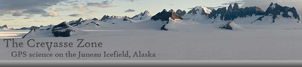
Welcome to The Crevasse Zone
Every summer since 1946, scientists
and students with the
Juneau Icefield Research Program (JIRP) have lived on and studied the Juneau Icefield in
southeast Alaska. One of the main projects conducted by the
program is measuring and monitoring glacier velocities and
surface elevation changes using high-precision GPS. The purpose
of this site is to present the data and results of these GPS
surveys.
Why the name Crevasse Zone?
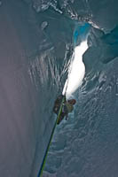 Simple. Crevasses are the number one
hazard encountered by those of us who live and work on glaciers.
All our survey work is done with GPS, often in total whiteout or
limited visibility conditions. And since crevasses and the
danger they present are constantly on our minds when we're on
the Icefield, and because I needed a catchy name for this web
site, I couldn't think of a more appropriate name than The
Crevasse Zone. Simple. Crevasses are the number one
hazard encountered by those of us who live and work on glaciers.
All our survey work is done with GPS, often in total whiteout or
limited visibility conditions. And since crevasses and the
danger they present are constantly on our minds when we're on
the Icefield, and because I needed a catchy name for this web
site, I couldn't think of a more appropriate name than The
Crevasse Zone.
A bit about myself...
I'm Scott McGee and I live in
Anchorage, Alaska. By profession I'm a GIS Specialist and
Cartographer for the U.S. Fish & Wildlife Service, specializing
in the application of GIS to land management issues within the
National Wildlife Refuges of Alaska. For the last 33 years I
have been a surveyor and faculty/staff member with the Juneau
Icefield Research Program. |
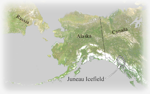
Where's the Juneau Icefield?
The Juneau Icefield is located
between the towns of Juneau and Skagway in Alaska and the town
of Atlin in British Columbia. It covers an area of about 1,700
square miles (4,400 square kilometers) and spans the
international boundary between the U.S. and Canada. It is one of
many icefields and glaciated areas stretching from southern
British Columbia to the Alaska Peninsula (see map below).
 |